SITE INVESTIGATION
Bekasi (Indonesian: Kota Bekasi) is a city in West Java, Indonesia, located on the eastern border of Jakarta within the Jabodetabek metropolitan region, as such it serves as a dormitory and factory city for Jakarta. The borders for this city are Bekasi Regency at the north, Bogor Regency and Depok City at the south, at the west is East Jakarta, at the east is Bekasi Regency. It is Indonesia's most populated incorporated city, and one of the most populated worldwide, but still trails the likes of Incheon and Yokohama. The large number of multinational companies, has apparently attracted a lot of expatriates (mainly Japanese and Korean) to settle in Bekasi. It has an area of 210.49 square kilometres (81.27 sq mi) and had 2,663,011 people in 2014. The 2010 population was 2,378,211, making it Indonesia's fourth largest city, and second in West Java only to Bandung. Many middle-up satellite cities have been developed in Bekasi, complete with their own shopping malls, schools, club houses, water park, and shuttle bus services to central Jakarta. Substantial urban areas surround the city. It serves as a commuter city for Jakarta, although it has notable trade, business and processing industries. These are primarily clustered in the area of Cikarang.
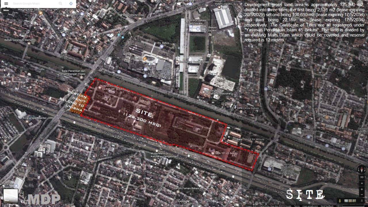
Development gross land area is approximately 125,300 m2, divided into three titles, the first being 2,531 m2 (lease expiring 20/5/2029) second being 100,610 m2 (lease expiring 17/5/2034) and third being 22,159 m2 (lease expiring 17/5/2034) respectively. The Certificate of Titles are all registered under “Yayasan Pendidikan Islam”. The land is divided by an existing Main Drain which could be covered and reserve required is 12 meters.
ANALYSIS
Current Ingress and egress is from Jalan Cut Meutia. A new access must be created from Jalan Chairil Anwar crossing the Kali Malang river / irrigation canal due to the expected heavy traffic volume that would be generated from the redevelopment scheme and another from the unnamed road at the Eastern boundary. No access is permitted from the existing Jakarta - Cikampek Highway located on the South of the University. Existing road at the Northern boundary has to be upgraded to accommodate the redevelopment scheme.
Building to building setback is 6 meters for low rise and 10 meters for high rise and we can go as high as 30-32 storey (notwithstanding that the allowable height is only 24 storey) with certain “considerations” fulfilled. Plinth Area is 60%, while Plot Ratio is 10.
SITE PHOTOS
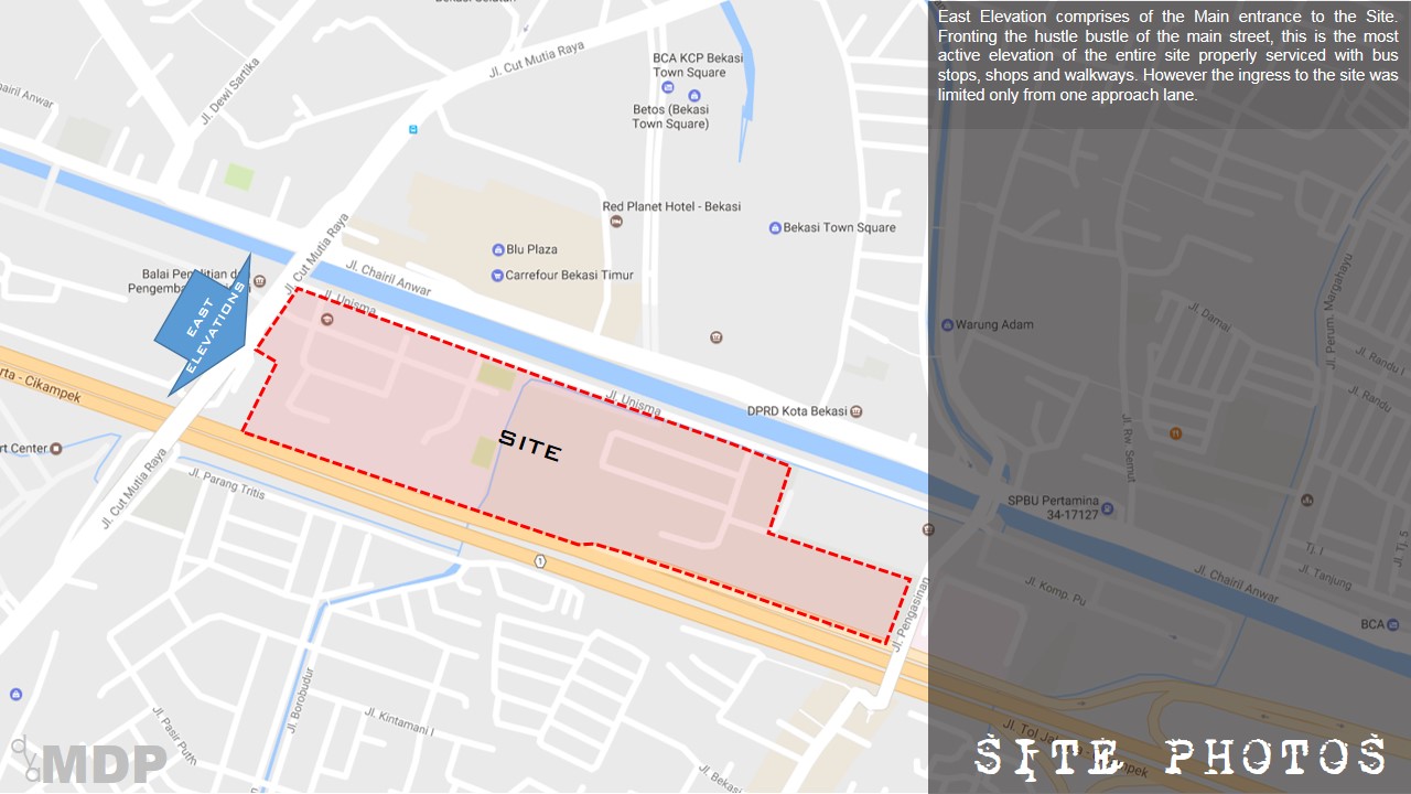
East Elevation comprises of the Main entrance to the Site. Fronting the hustle bustle of the main street, this is the most active elevation of the entire site properly serviced with bus stops, shops and walkways. However the ingress to the site was limited only from one approach lane.
This is the Passive Elevation of the site and the most scenic of them all. Defined by the river, a bunk has been erected elevated from the internal road as a protective screen between the road and the river as flood prevention. A Watergate is located somewhere to allow for water drainage into the internal monsoon drain that cut through the site. A structure that mimic lifting station was found with graffiti all over. The site parameter has been walled up as a canvas for the artistic souls. Along the street, stalls were observed to provide FnB for the students. The water quality of the river is murky but clear of debris and foul smell. A decent park for people to hang around is viable.
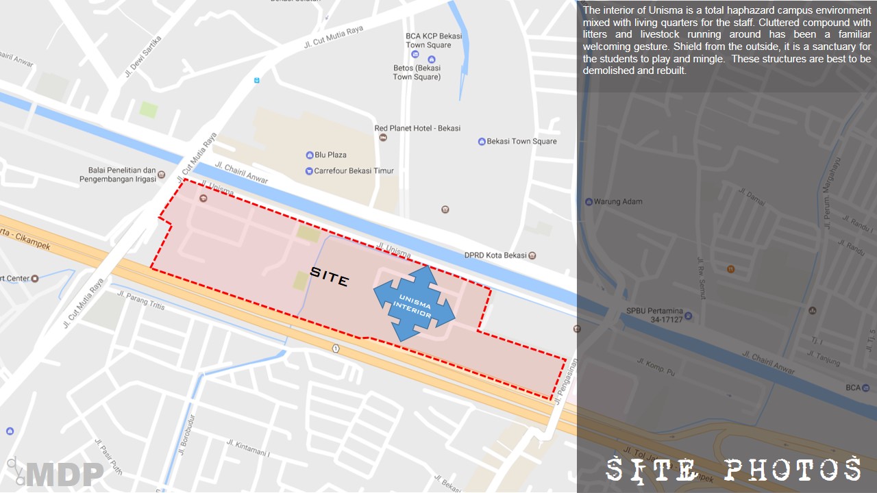
The interior of Unisma is a total haphazard campus environment mixed with living quarters for the staff. Cluttered compound with litters and livestock running around has been a familiar welcoming gesture. Shield from the outside, it is a sanctuary for the students to play and mingle. These structures are best to be demolished and rebuilt.
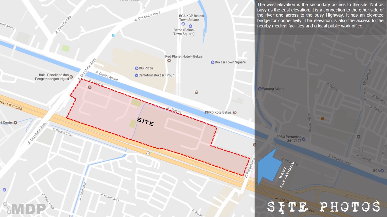
The west elevation is the secondary access to the site. Not as busy as the east elevation, it is a connection to the other side of the river and across to the busy Highway. It has an elevated bridge for connectivity. The elevation is also the access to the nearby medical facilities and a local public work office.
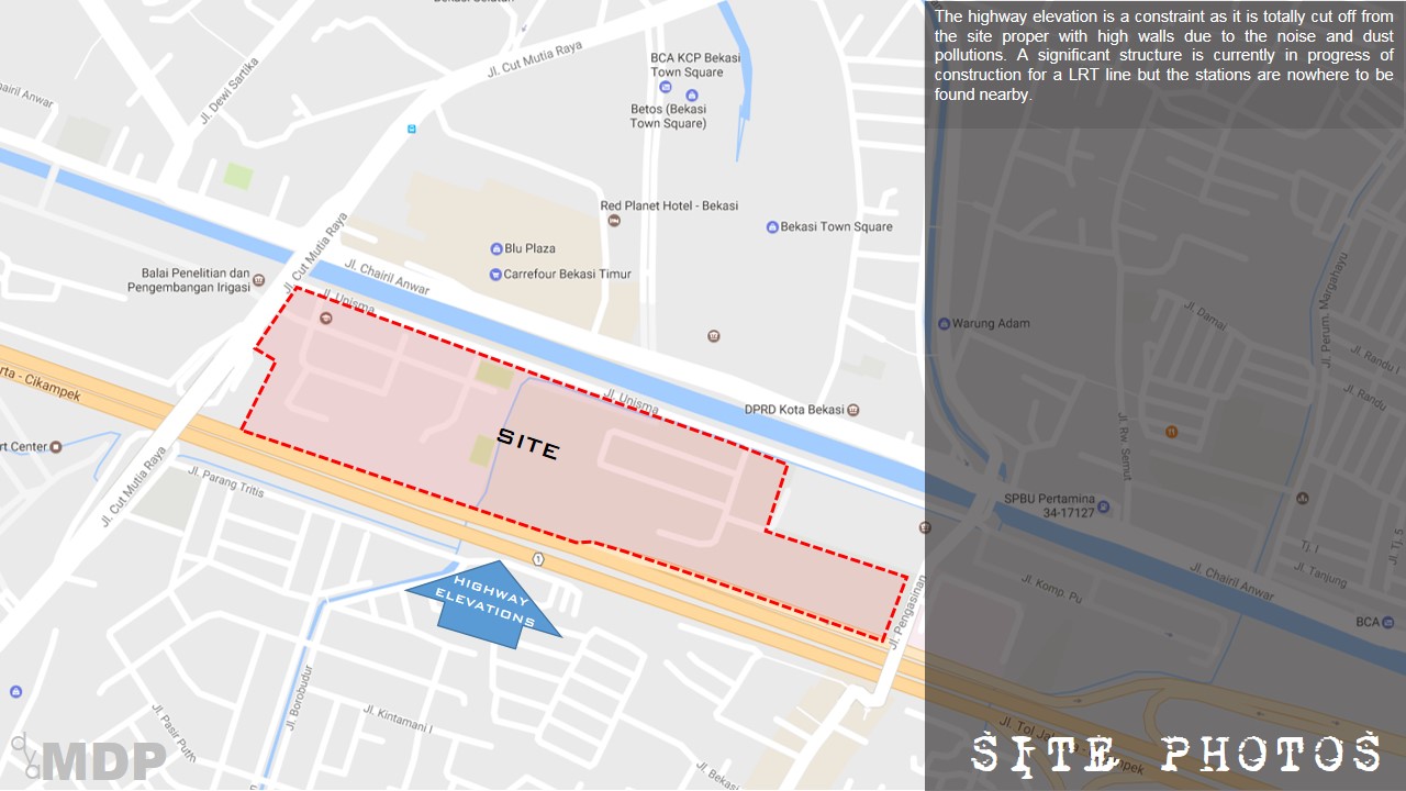
The highway elevation is a constraint as it is totally cut off from the site proper with high walls due to the noise and dust pollutions. A significant structure is currently in progress of construction for a LRT line but the stations are nowhere to be found nearby.
POTENTIALS
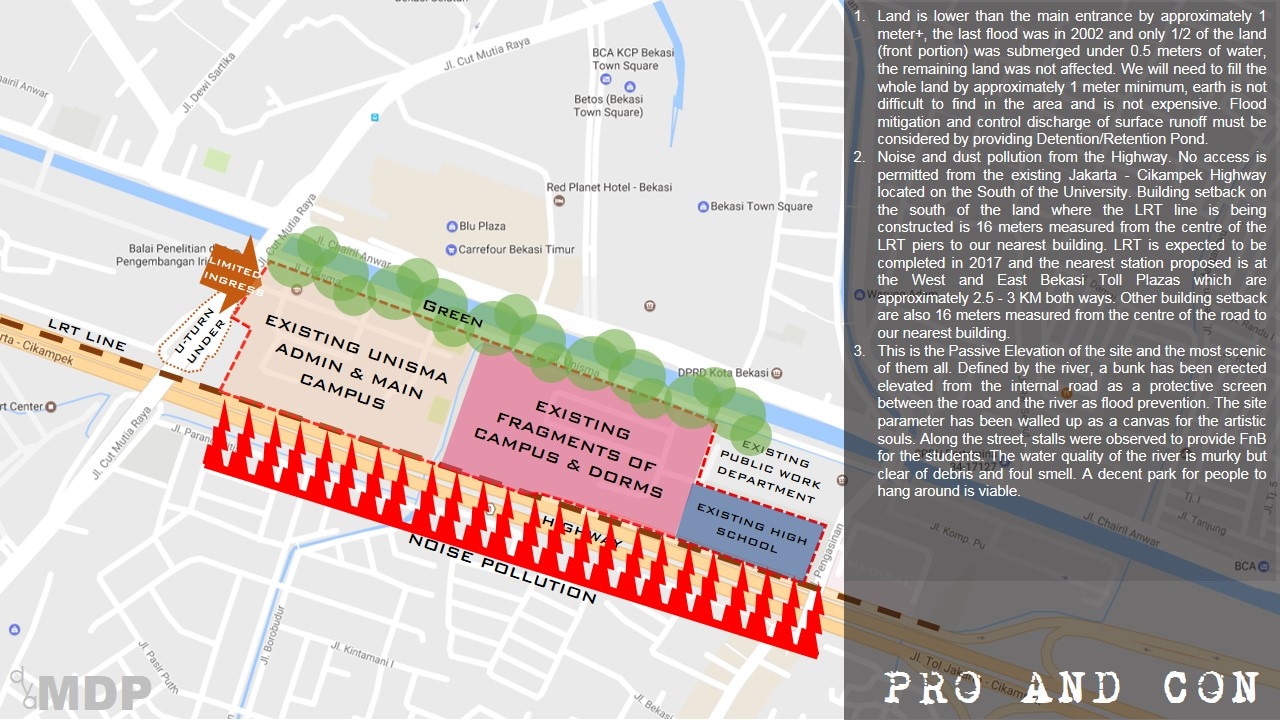
- Land is lower than the main entrance by approximately 1 meter+, the last flood was in 2002 and only 1/2 of the land (front portion) was submerged under 0.5 meters of water, the remaining land was not affected. We will need to fill the whole land by approximately 1 meter minimum, earth is not difficult to find in the area and is not expensive. Flood mitigation and control discharge of surface runoff must be considered by providing Detention/Retention Pond.
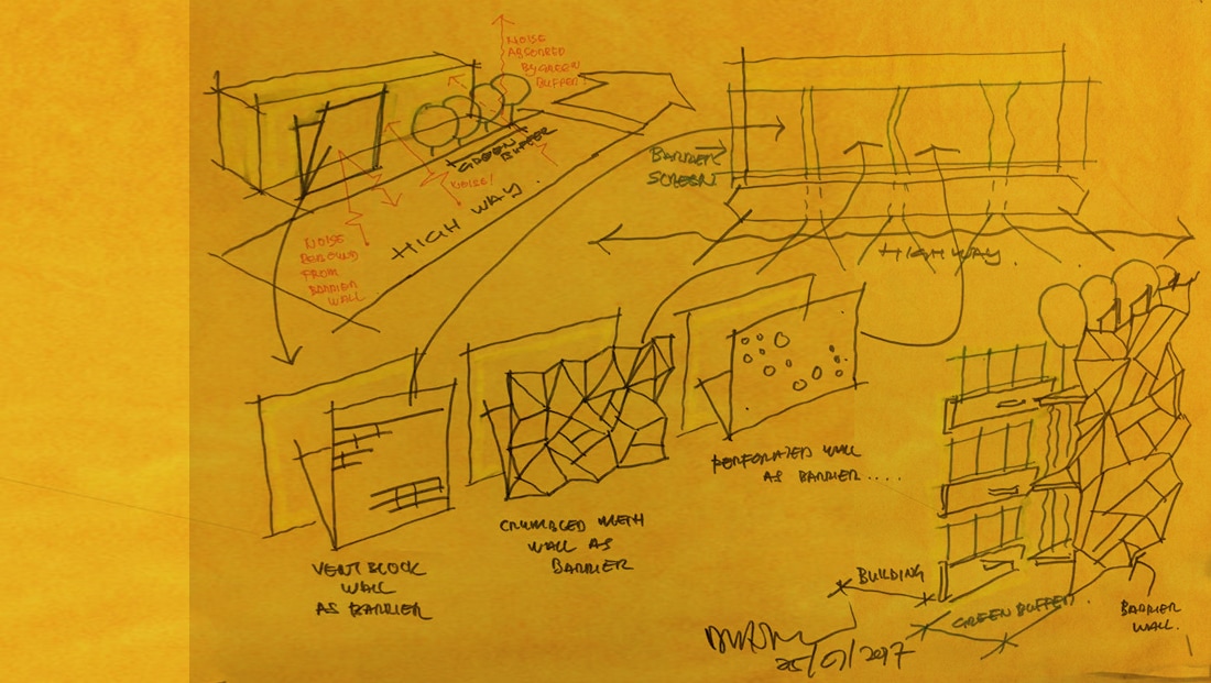
- Noise and dust pollution from the Highway. No access is permitted from the existing Jakarta - Cikampek Highway located on the South of the University. Building setback on the south of the land where the LRT line is being constructed is 16 meters measured from the centre of the LRT piers to our nearest building. LRT is expected to be completed in 2017 and the nearest station proposed is at the West and East Bekasi Toll Plazas which are approximately 2.5 - 3 KM both ways. Other building setback are also 16 meters measured from the centre of the road to our nearest building.
- This is the Passive Elevation of the site and the most scenic of them all. Defined by the river, a bunk has been erected elevated from the internal road as a protective screen between the road and the river as flood prevention. The site parameter has been walled up as a canvas for the artistic souls. Along the street, stalls were observed to provide FnB for the students. The water quality of the river is murky but clear of debris and foul smell. A decent park for people to hang around is viable.
DEVELOPMENT COMPONENTS
|
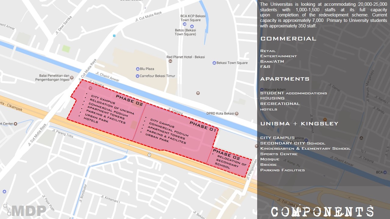
The Universitas is looking at accommodating 20,000-25,000 students with 1,000-1,500 staffs at its full capacity upon completion of the redevelopment scheme. Current capacity is approximately 7,000 Primary to University students with approximately 350 staff.
COMMERCIAL Retail Entertainment Bank/ATM F&B |
APARTMENTS
STUDENT accommodations HOUSING RECREATIONAL hotels UKIH CITY CAMPUS SECONDARY CITY School Kindergarten & Elementary School Sports Centre Mosque Bridge Parking Facilities |
URBAN DESIGN SCHEMATIC
|
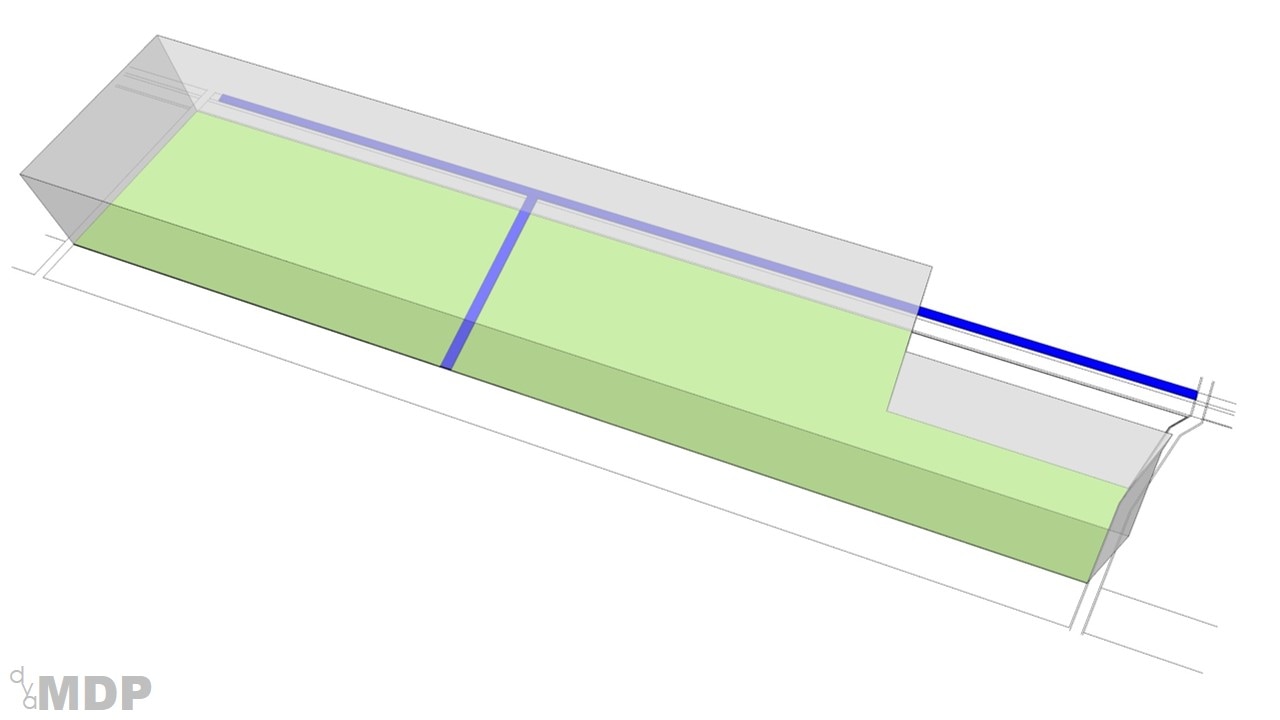
The first attempt is to max up the entire site to reach its Plot Ratio estimated at 9. This is where it gets to. A humongous block of monolith.
|
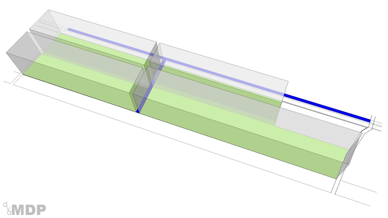
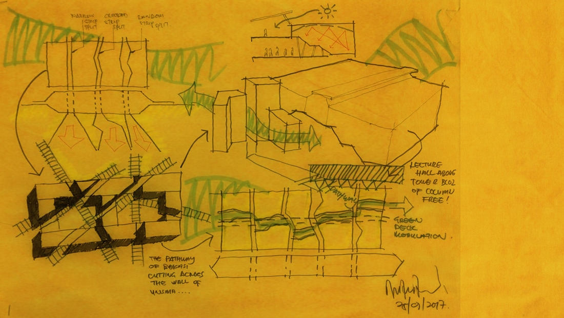
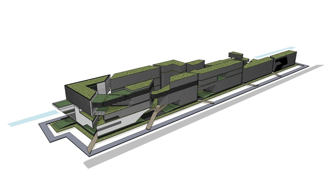
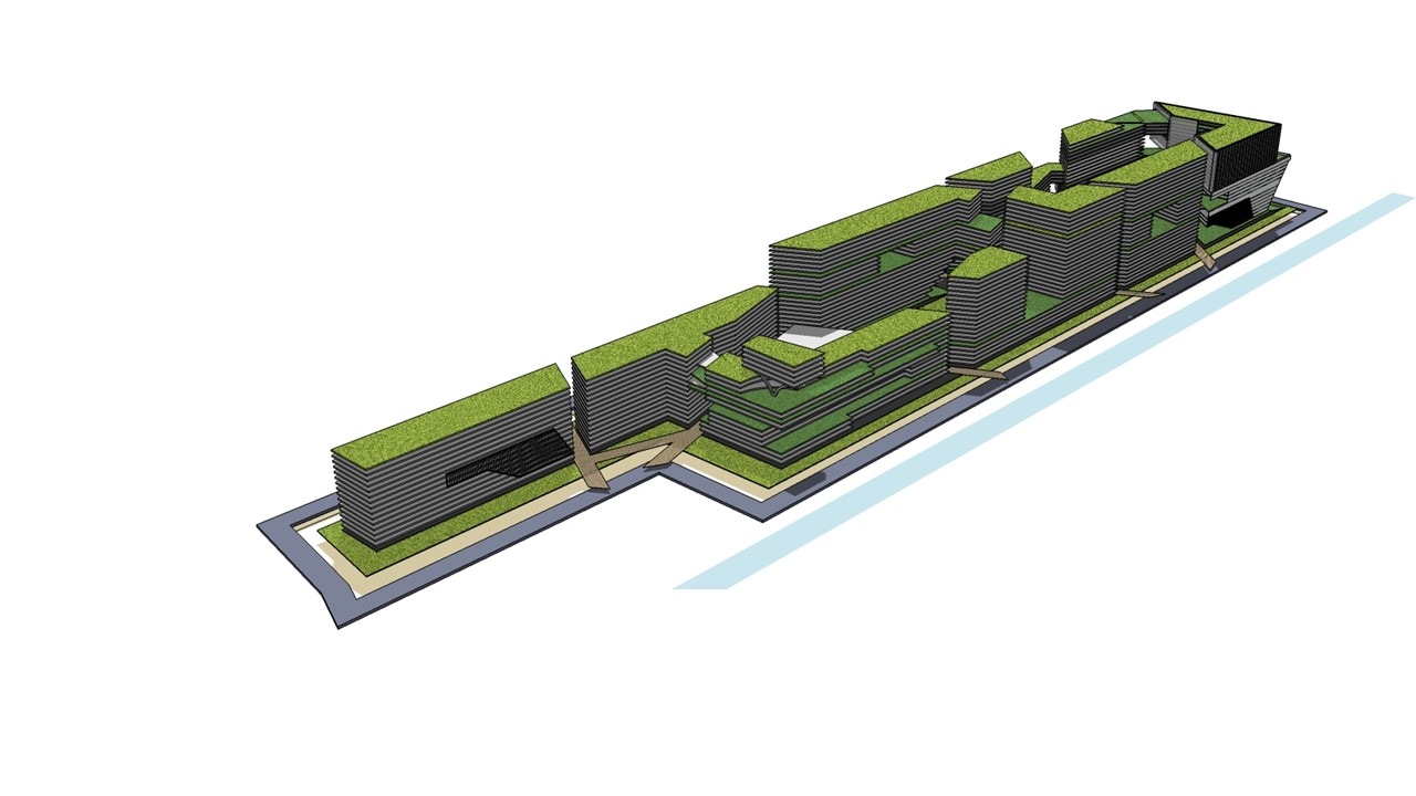
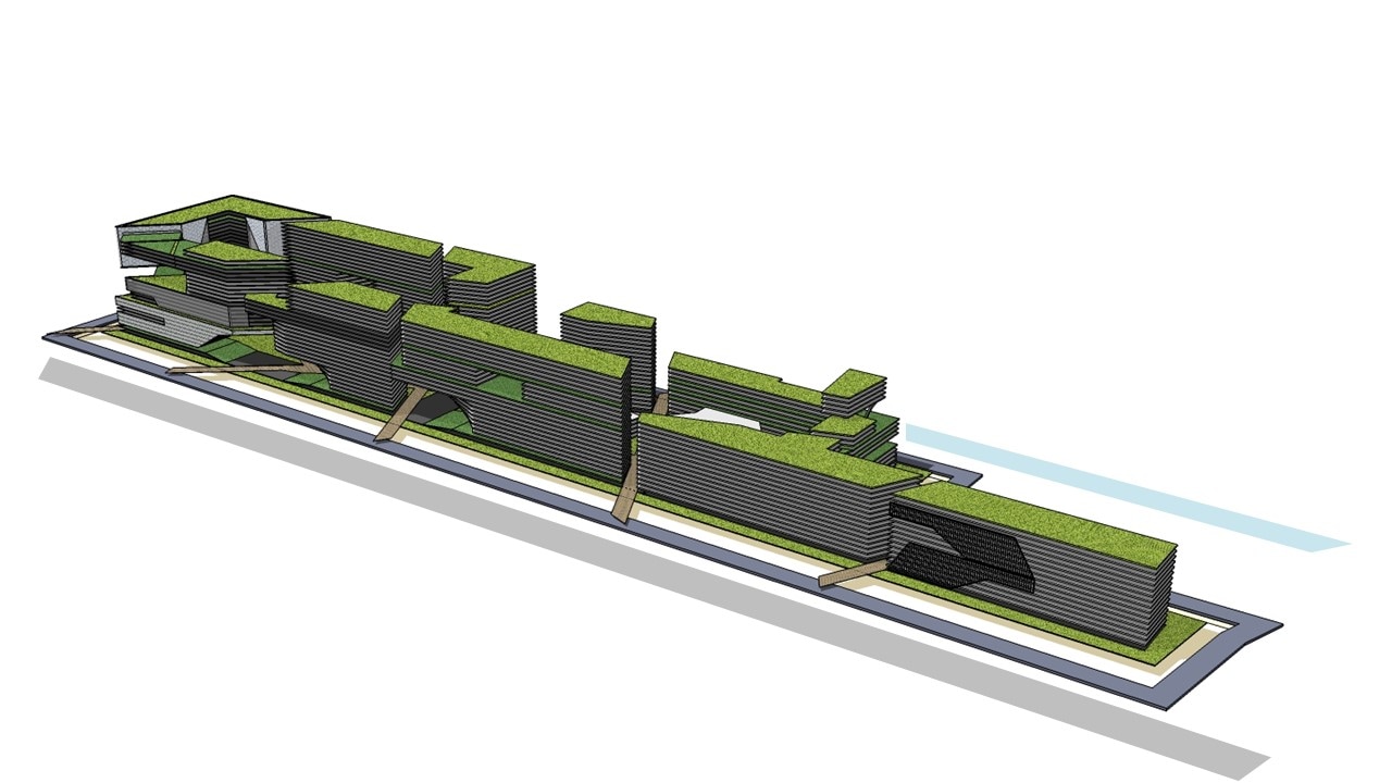
Next, we dissect the monolith into the axis of grid. These defined the podium block. The cracks are further developed into Green parks.
|
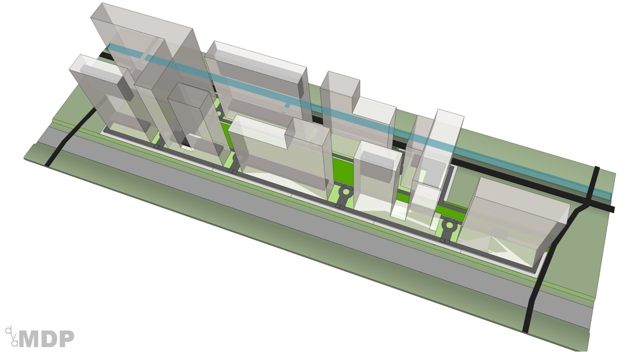
Subsequently, the subtracted spaces are piled up against one another forming the tower block. Capitalizing on the North South axis for minimum solar gain.
|
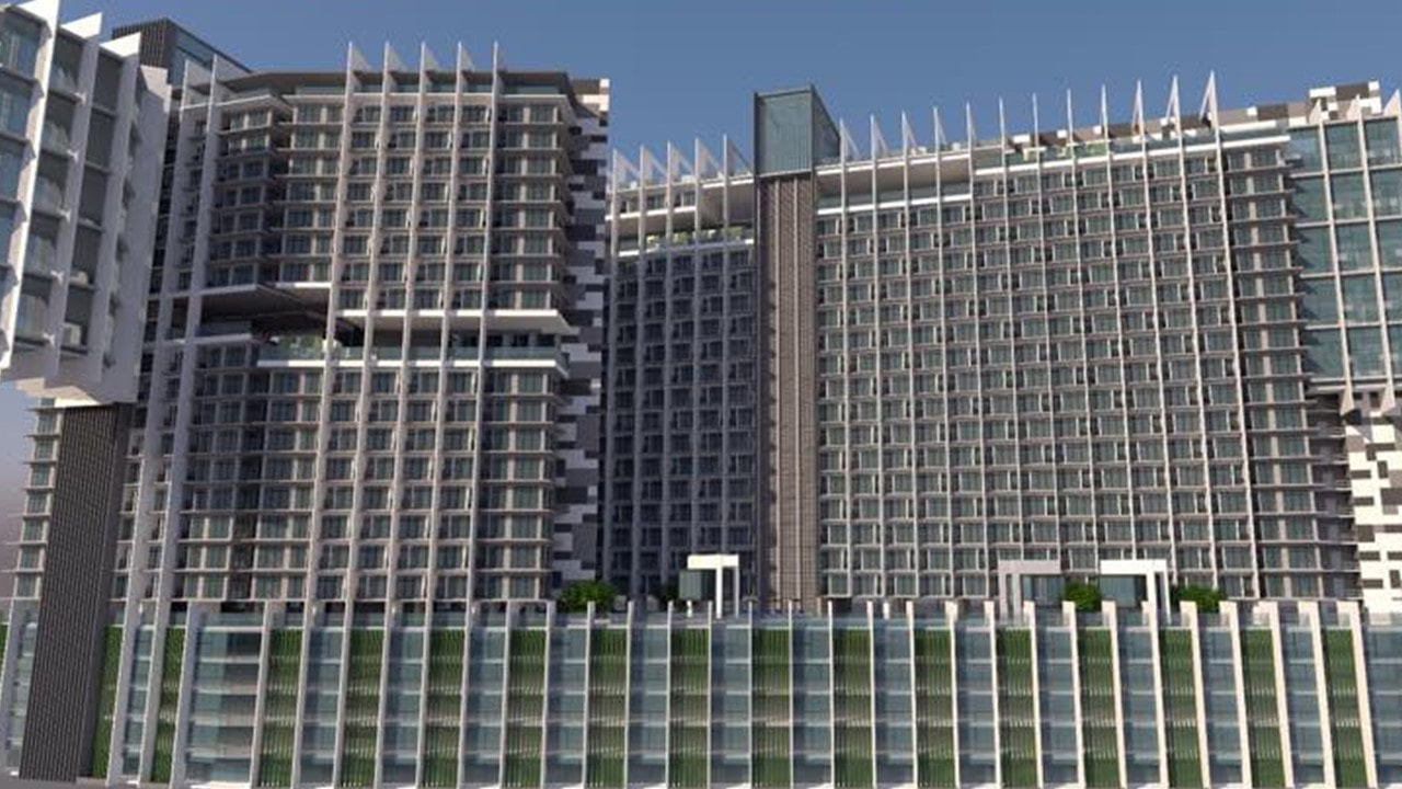
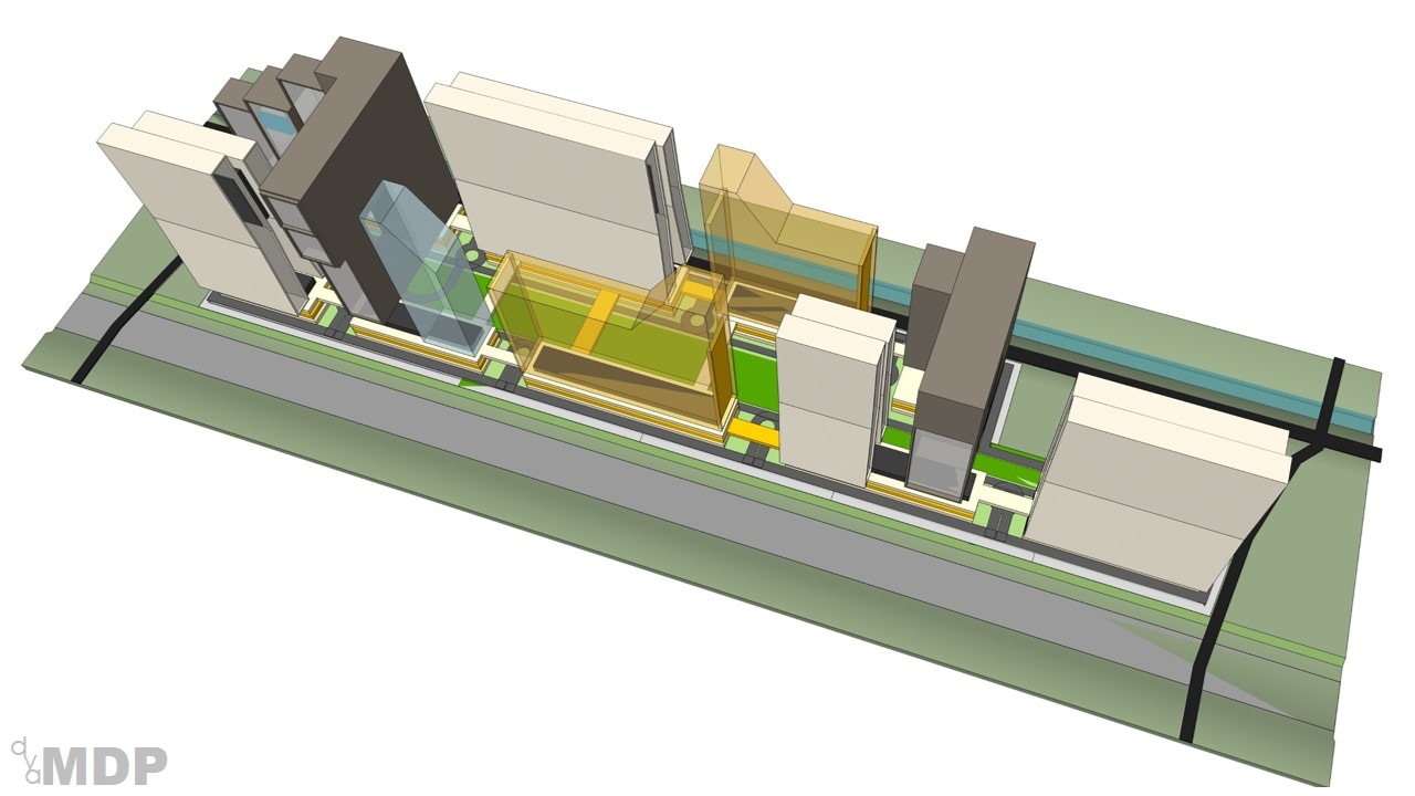
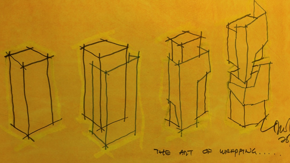
Further, we individually treating the tower block into recognizable icons, each with its own distinctive character yet coherently binding.
|
THE LAYOUT
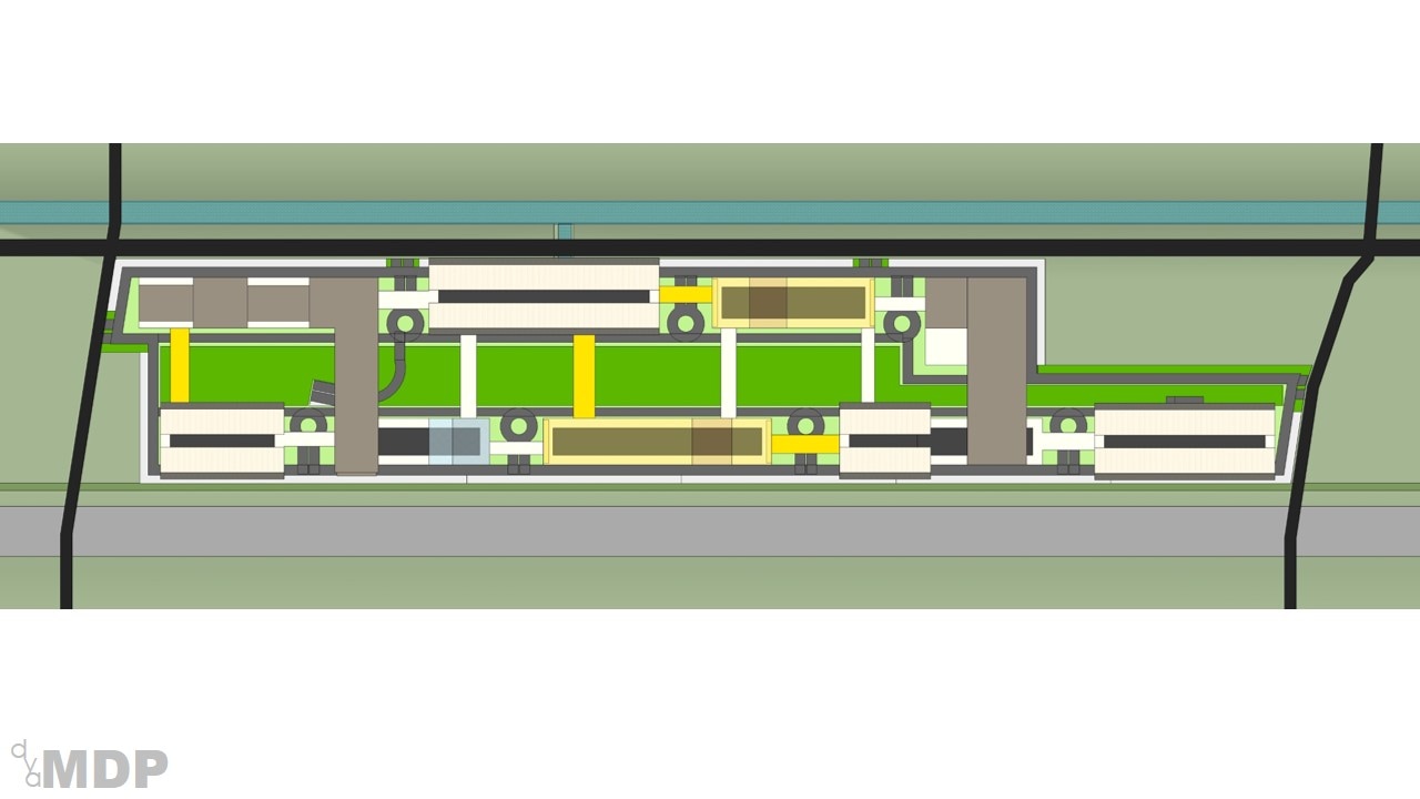
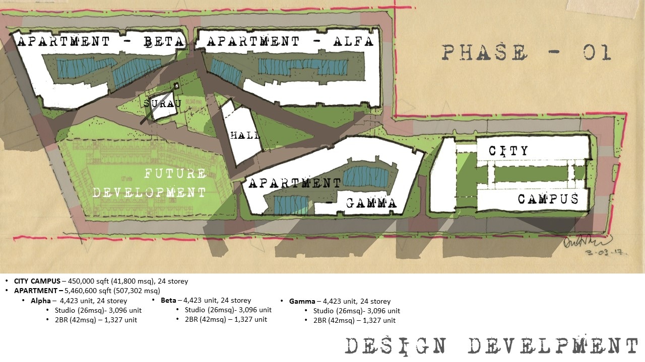
The entire plan has been transformed into the over-lapses of rectangular arrayed along the axial park. This urban park shall be the linkages free of obstructive vehicular access that are only allow on the basement. The linear park shall witness the juxtaposition of football fields, recreational fields, water bodies, parks and so forth for the common communities of the students and users alike. The entire space will be warped up as what commonly known as City Campus. A campus spread along the communities of facilities, offices, hotels, retails and so forth.
THE SKETCHES
Based on Knight Frank Summary:
- Site within the Safety of Flight operation area – 24 storeys Max. We may need to reduce our Plot Ratio from 9 to 7…
- Without the proper Pre-Comp and Detail Survey, the actual site boundary cannot be established…
- 10m setbacks from the highway. No mention about River setback or reserve…
- Multiple micro planning conditions within the site – Pak Yoppy Happyanto (Area Planning Personnel)
- Comprises of Multi Zone within the same site – Mixed Use, Education, Green, Government, Regional public office… To apply for Advise Planning for Zoning Change & Detail Allowable Development Plan.
- Regulation – Dev Ratio 1:2:3 (Lux:Mid:Low), apply to landed only. Apartments – 20% reserved for LowCost… No idea how their LowCost apartment configuration looks like?
- SWOT – Accessibility issue, within the lower income enclave contradictory to competition with existing superblocks…
- SuperBlocks – Main Attraction, Hospital + Theme Park + LRT + Mall + Edu Hub. Amenities, SPICE + Lifestyles + Sports.
- Apartment Matrix – STUDIO (35msq) 53%, 2BR (154msq) 26%, 1BR (77msq) 16%, 3BR (170msq) 5%. Conclusion, high demand for Studio and 2BR types… + 79%.
- SPECULATIVE: Limited supply only 4. 79% occupancy. Avg take up rate – 95%.
- BOUTIQUE: Limited supply only 6.
- No mention about the configuration of SPECULATIVE and BOUTIQUE…
- MALL: 15 malls - Occupancy 80%.
- HOTEL: 13 – Maj 4 stars 70% with 67% occupancy rate. Room type – SD: 14msq (40%) DL: 18msq (49%) EX: 30msq (6%) S: 40msq (5%). Room avg – 200. Demand 80 domestic, 20% foreigner. For Business – 80%
- HOSPITAL: Avg 200 beds. No Layout configuration provided…
- EDU HUB: Mostly occupy by locals. Uni – 7000 pax, Sch – 50-1000. No Layout configuration provided…
DESIGN DEVELOPMENT
Components - City Campus, Apartments, Commercials, Hotels, Office Suites, Medical Suites... Facing the Highway - Active Zone. Comprising of Commercials, City Campus, Hotels, Office Suites and Commercials. Require Noise Reduction strategies such as Buffer and Screen Wall. Double Glaze preferred. Facing the River - Passive Zone. Comprising mainly Residential Apartments and Medical Suites. Capitalize on the serenity of the River View. Entire site punctuated and connected with series of Green Lungs at ground level. Iconic Mosque and Indoor Stadium as landmark. Roof level greens at different levels link and bind these different blocks together.

